Per Chambers EMA, the weather service has continuously stated that this forecast is difficult for what area may get snow and how much. Best case scenario, it continues to move south and we get nothing. Worst case scenario is we get snow. What’s different about this snow that makes travel hazardous to dangerous? Any amount of snow whether a dusting or 2 inches will cause hazardous travel because the temperatures are below or near freezing when it starts, and have been for a couple of days, and remain below freezing during and after the event into the night and morning of Wednesday. When vehicles travel over the snow it packs it down, melts it, and will almost immediately refreeze becoming ice. What has been consistent is tge concern for prolonged extreme cold temperatures. When outside, Any exposed skin is at risk of frost bite and people are at risk of hypothermia which can set in quickly.
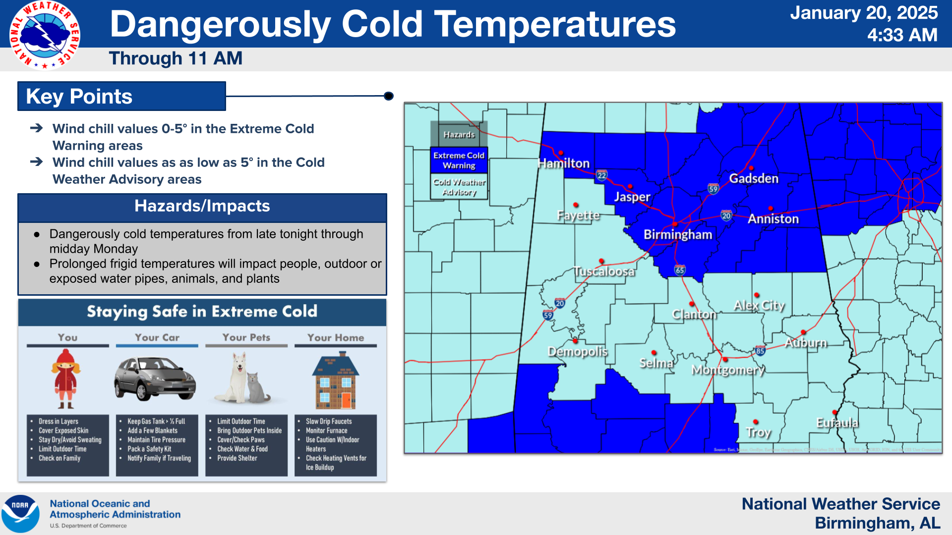
Arctic air has moved into the area, and breezy northerly winds are leading to dangerous wind chills that will persist through much of this morning. We continue to track the threat for winter weather across the area Tuesday and Tuesday night. The forecast continues to evolve, and we have made some impact-based decisions for areas near US Hwy 80 and Interstate 85.
1. Cold Temperatures: Arctic air will remain across Central Alabama for the next few days. Dangerous wind chills are expected during the overnight and morning hours through Wednesday morning.
2. Winter Weather: Probabilities for accumulating snow have condensed to areas across southern Alabama, generally along and south of US Hwy 80. Snow amounts up to 2″ are possible across the warning area, with amounts up to 1″ across the watch area. Snow accumulations and very cold temperatures Tuesday night could result in travel impacts that could extend into the morning hours on Wednesday.
Changes from previous forecast: Changes were made to snow totals, with amounts decreasing and shifted southward. Areas south were upgraded to a warning.