

According to the Chambers EMA, cold weather is forecast across Central Alabama much of next week, with dangerous wind chill values at times. Multiple nights (Sunday night through Thursday night) will see sub-20F lows and sub-10F wind chills. In addition, accumulating snow is appearing more probable for Tuesday and Tuesday night, generally south of Interstate 20.
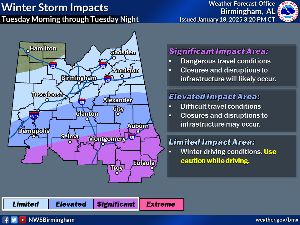
Changes from previous forecast: Adjustments to Winter Impact graphic (introduction of Significant Impact area), updated probabilities of >1″ snowfall and <10F wind chills
1. Cold Temperatures: Arctic air is forecast to arrive in Central Alabama Sunday night into Monday morning. This will correspond with gusty winds to produce wind chill values in the single digits during the morning commute Monday. Similar conditions are forecast Tuesday morning with wind chills in the single digits to lower teens. Impacts to people, outdoor water pipes, animals, and plants are possible throughout the prolonged period of frigid temperatures Sunday night through at least Thursday
2. Winter Weather: Probabilities for accumulating snow have increased for much of Central Alabama for Tuesday into Tuesday night due to a low pressure system in the Gulf, especially south of Interstate 20. Our official forecast amounts have increased as well, though these values will change with subsequent updates. With temperatures falling into the teens Tuesday night, travel impacts are looking more likely into Wednesday morning even with light accumulations.