A wintry mix began over the norther 3rd of the county about 330 am EST and sleet began along and south of Lanett / Huguley to Valley about 4am and transitioned to a light but steady snow about 5am
The current temp in Huguley / Valley area is about 34, about 31 / 32 in the Lafayette area and road temps are at about 32 according to the NWS RWIS tabular, which is in general and not from every road, some roads are likely already cooler by a degree or 2.
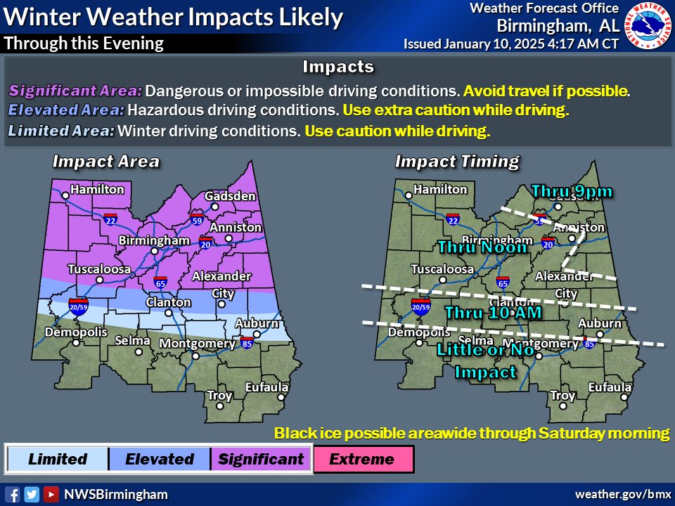
Extreme northern Chambers has been added to the Significant impact area and the remainder of Chambers to the 85 corridor has been added to the elevated impact area – through 10 am CST
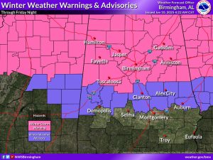
Pickens, Tuscaloosa, Bibb, Shelby, Talladega, Clay, and Randolph counties have been upgraded to a Winter Storm Warning. Many roadways in Central Alabama are becoming snow/ice covered and hazardous. Travel in the warning and advisory areas is not recommended at this time.
Winter Weather Advisory has been issued until January 10 at 3:00PM CST by NWS Birmingham AL: * WHAT…Mixed precipitation expected. Total snow and sleet accumulations up to one inch and ice accumulations around one tenth of an inch.
* WHEN…Until 3 PM CST Friday.
* IMPACTS…Roads, and especially bridges and overpasses, will
likely become slick and hazardous. Plan on slippery road
conditions. The hazardous conditions could impact the Friday morning commute.
A look at predicted temps, wind chill, surface winds & speed over the next few hours – if we have any issues with ice on roadways, bridges, overpasses, etc. it will be likely being during the 6/7 am EST – 9 / 10 am EST time frame.